
Hiking/Walking - Trail Maps
New Hartford is home to several land preserves with hiking and walking trails as well as Nepaug State Forest. Our Open Space Preservation Commission members have set up additional trail guides on the Alltrails website and smartphone app. The links to use the GPS on a smartphone to follow the trails are also included below.
Antolini Woods
Antolini - Goula Traverse
is a trail recently completed from Antolini through the Surdam property, through Phillips Farm, through to the end of the Goula open space property on Cotton Hill Road. Click here to link to the Alltrails recording for this route.
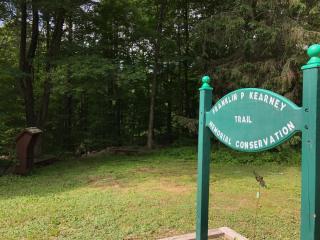
Brodie Park South
is located on Niles Road just south of West Hill Road. Parking is available off Niles Road or across West Hill Road in the lot for Berkshire Hall. Click here for the Brodie Park South trail map. Click here to link to the Alltrails recording for the Franklin P. Kearney Memorial Nature Trail.
Goula Open Space Area
is the first property acquired and permanently preserved under the Town's Open Space Program. This 118 acre parcel is located on Cotton Hill Road. The entrance is about 1.6 miles from Route 202. Parking is located behind the cedar information box posted along the east side of the road at the entrance to the main field on the propery. Click here for general information on Goula Open Space Preserve. Click here to link to Antolini - Goula Traverse trail map.
Helen Butler Riverfront Trail
is located off Blackbridge Road. Click here to link to the Alltrails Recording.
Jones Mountain
is located on Steele Road. Click here for the Jones Mountain trail map.
Phillips Farm
is located on East Cotton Hill Road. Click here for the Phillips Farm trail map.
Surdam Farm Preserve
is located on East Cotton Hill Road across from Phillips Farm. Click here for the Surdam Farm Preserve trail map.
Nepaug State Forest
is located on Route 202 3.1 miles west of the junction of Route 202 and Route 44. There is no parking fee. Activities include Biking, Camping, Cross-Country Skiing, Fishing, Hiking, Letterboxing and Hunting. Click here for a map of the Nepaug State Forest.
American Legion and People's State Forests
are located off East River Road or West River Road in Barkhamsted. Click here for a trail map.